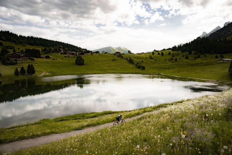
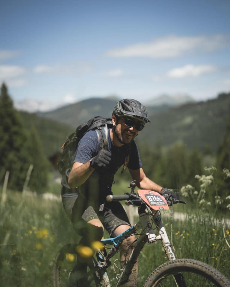
e-Rando 20-37 km
Summit of the Crêt du Merle chairlift (access via the chairlift)
Champ Giguet - La Clusaz
| Before Sunday, April 6 | 30€ + 1€* |
| After Sunday, April 6 | 36€ + 1€* |
| *For the association *For the association La Clusaz / Aravis - Pama / Kompienga | |
| Club rate, from the 8th person: -10%. |
e-Rando 20-37 km
Le Bélier is a very strong character but he also knows how to please you!
In addition to our XC formats, we also offer randos!
New for 2025: VTT and VTTAE, same Start, same adventure!🔥Because it's more fun to ride together, the 20 km and 37 kmrando joins forces with the 20 km and 37 km rando .
This year, you'll take the same Start for an adventure as grand as ever, with your choice of mountVTT or electric)! But there's no change to the essentials: the routes remain identical, with breathtaking scenery.
Depending on how you feel, you can stop at 20 km or extend the pleasure to 37 km.
No time limit, no pressure, full fun!
- StartCrêt du Merle from 9:30 am to 11:00 am
- Arrival: Champ Giguet
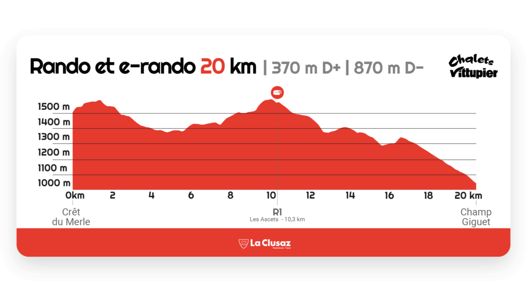
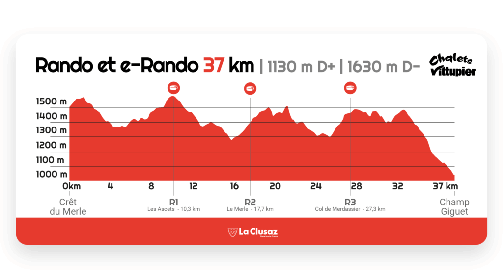
- Distance: 20.4 km or 37.5 km by VTTAE
- Difference in altitude: 20 km > 370 m D+ | 870 m D- // 37 km > 100 m D+ | 1630 m D13
- Registration fees: Before April 6, 30€ + 1€ and after April 6, 36€ + 1€ for the association
- Categories: Cadets and above (born in 2010 and earlier)
- Event reserved for electrically assisted bicycles
- No reloading is possible on the course.
- Refreshment points : Bout de l'Extension km - Lettre La Clusaz - Col de Merdassier
- Safety and rescue on the course and at the finish
- A souvenir of the event
- Compulsory equipment: Approved rigid helmet
- Recommended equipment: Pair of long gloves
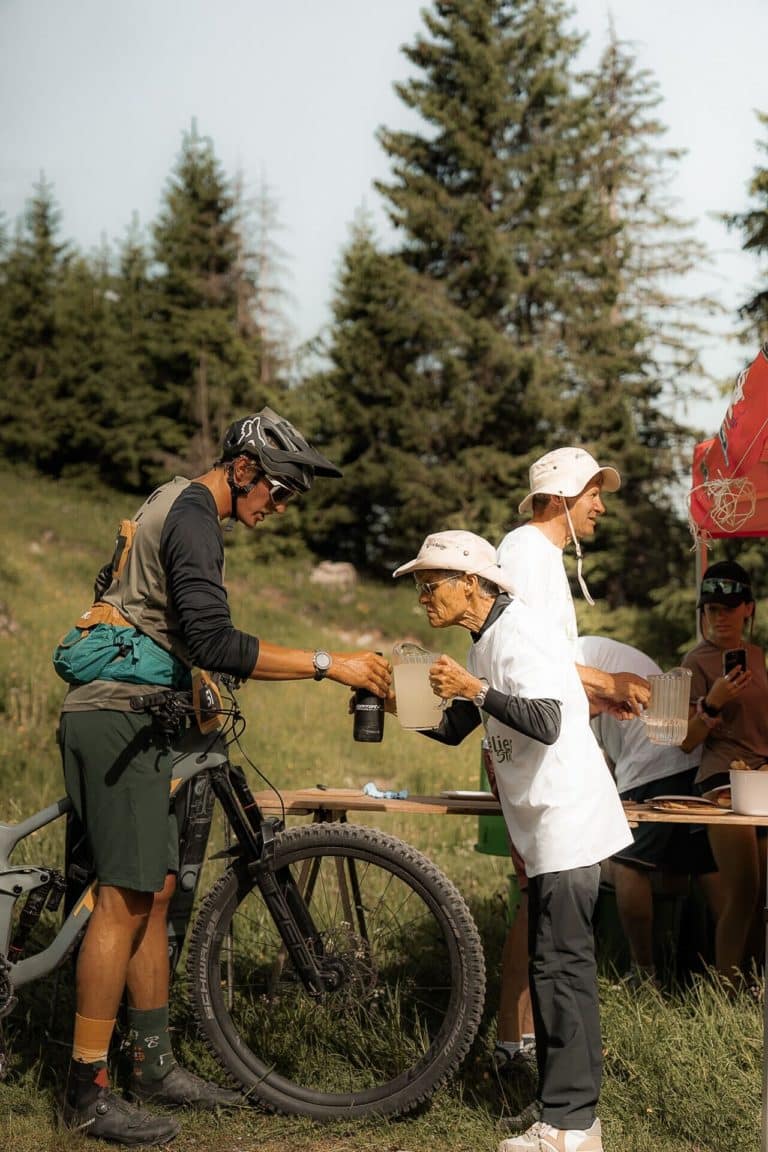
Thank you to our volunteers!
A huge THANK YOU to our volunteers! 💛 This weekend, le Bélier VTT wouldn't have been the same without you!
THANK YOU 💛
🌟 What a crazy weekend, and it's largely thanks to you! 😍
The 2025 program
The whole team is ready to welcome you in La Clusaz, to live together a friendly and sportive weekend.